Much to TJ's chagrin, I scheduled a brewery tour (one of those online deals) on the day of an ultramarathon he would've liked to run. But I didn't feel too bad because I figured he would stop caring after the second tour stop. Much to my chagrin, the night before our tour, the company called to cancel because the scheduled driver had a heart attack and ended up in the hospital, and no replacement could be found on such short notice. Obviously, it was too late for TJ to sign up for the race, so to make up for the unfortunate turn of events, we decided to take a marathon road trip, from one type of tree to another.
Fittingly, on our first day, we took the
Pines to Palm Highway. When we made a pit stop to check out the Pacific Crest Trail where it crossed California Highway 74, we could see snow on the mountains in the distance (left). By the time we stopped at the highway's Cahuilla Tewanet Overlook (right), my flip-flops were no longer adequate foot protection -- and we hadn't even encountered the lowest temperatures of the weekend.


We arrived at
Joshua Tree National Park pretty late in the evening, after all of the central first-come, first-serve sites were taken, so we stayed at
Black Rock Canyon Campground, near Yucca Valley. Even though it was on the outskirts of the park, we set up camp near plenty of the eponymous trees, which are said to look like Joshua from the Bible praying to the sky (left). Don't let the clear skies fool you, it dropped to an ungodly low temperature -- below freezing -- in the desert that night. Luckily, the next day, with the sun back out, we were able to not only warm up but also look at the San Andreas Fault from
Keys View within in the park (right).
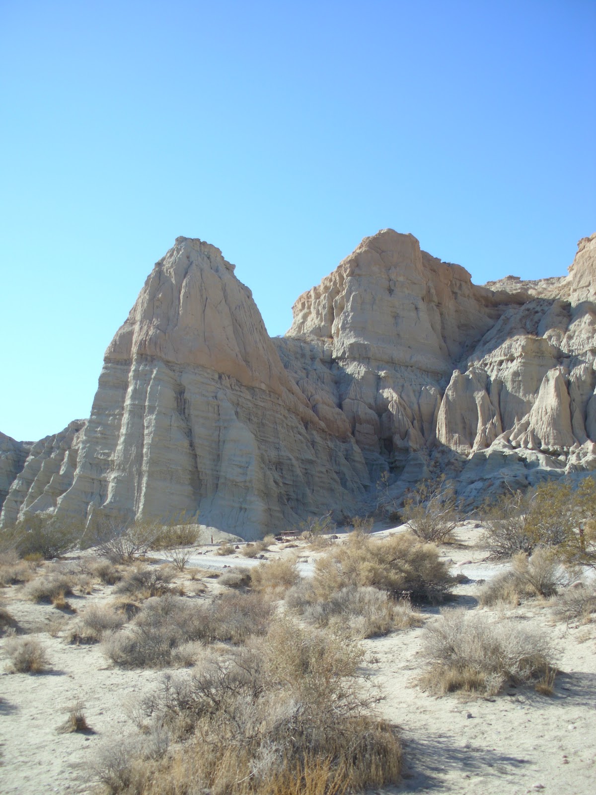
We were hoping to make it to our next type of tree, the sequoia, in the same day. But after one cold night, I was in no hurry to race to the low temperatures of the mountains. In fact, we were running out of daylight by the time we pulled into the more temperate
Red Rocks Canyon State Park (left). The park is described as a mini-Grand Canyon; I've never been, but indeed, I was impressed by the interesting rock formations (right), some of which you could even camp in.
Once again, our best-laid plans were thwarted when the road we were hoping to take through
Sequoia National Forest was closed. Nonetheless, we decided to head as far as we could go -- where there was more snow (left) -- in hopes of seeing some of the tall trees. The forest is named after the 33 groves of giant sequoias within it, but with our path blocked, we settled for the serenity of some simply high pines (right).
Actually, had we known that run-of-the-mill evergreens were all we were going to see, we could've stopped on California Highway 178 near the
Audubon Kern River Preserve. In fact, we didn't even need to go all the way east to Joshua Tree in the first place, considering we could see both the yucca and conifer trees in a single vista from the road.
But the long-distance, though not fast-paced, weekend trip was still worth it for the discovery of the
Kern River (left), a gorgeous series of rapids that runs through the cute fishing town of
Kernville down to Wofford Heights, where the water broadens into
Lake Isabella (right) for a bit before it heads on Bakersfield.


No comments:
Post a Comment