Thursday, August 24, 2017

Personal exploration, growth and total immersion in one's work (142Cong.Rec.E376)

More than two years ago, I took a test that determined that, on a scale with 5 being the best, I speak and read Russian at a level 2. I tried, I really did, to maintain my language skills while in London, but it was clear upon my arrival in Ukraine that I was way behind. Many of my colleagues are native or heritage speakers, so they speak and read at level 3 or above. My supervisors believe, and I agree, that a level 3 is much more ideal for doing one's job. And so, two weeks after settling into Kyiv, I fled town for a language immersion trip. 

The goal of my weekend in Chernigiv was to bombard myself with so much Russian as to jump-start my language skills. And indeed, it did. During my time staying with my host mother Lyudmila, I only heard English a few times, including when I taught her how to say "watermelon." But I also got a crash course in Ukrainian culture, as viewed through the spare bedroom of Lyudmila's flat on the outskirts of town (left). As we walked through the adjacent forest, she picked berries for me to eat right off the bushes, and when we strolled through downtown, she took photos of me next to nearly every fountain (right).
 
Coincidentally, before I knew I would be doing the immersion trip, I had signed up for a day tour of Chernigiv. Luckily, the city is full of interesting sights, so there was little overlap during the back-to-back weekends. Both visits, we stopped by Transfiguration Cathedral, one of the oldest cathedrals in Ukraine. It was built in the 11th century, but it was burnt down and reconstructed in the 18th century. Only a bit of the the original structure can be seen on one of the towers (left), but nonetheless, once inside, you definitely feel like you are stepping into ancient history (right).
Both times, we passed by, but didn't enter, St. Catherine's Cathedral, a restored 18th-century church that can been seen from many directions, including from the town's lengthy pedestrian boulevard (left). It also can be viewed from the Citadel, the site of a medieval fortress that once defended the city (right). The church itself has a connection to conflict: During World War II, it was badly burnt while being used as a storage room by the Nazis. 
Nowadays, more love than war appears to be made in the city. In one park near the municipal building, there is a pergola where lovers demonstrate their devotion with symbolic locks (left). Another tradition, at least according to the four brides and grooms who were being photographed during my second visit, is to have wedding shots taken in Detinets Park (right).
Another common photo op in the park is at the Shevchenko sculpture, where people shake the hand or share the bench of the Ukrainian writer (top left). But in my opinion, the best vistas to put in your viewfinder are those of the Desna River (top right). From the same viewing platform, you can look across the city's hills to see its many church towers (bottom).
The most prominent columns are the spire and bell tower of Trinity Monastery. During the second visit, we made it to the monastery with 10 minutes to spare to climb the bell tower (top left). I got quite the glute workout as I scaled the stairs to the top, where I could look back to the cathedrals near the Citadel (top right). It also provided a good view of the monastery cathedral (bottom left). I was able to snap only one shot in the cathedral before I was shooed out because services were starting (bottom right). 
 
A little further down the road and quite a bit less obvious is another monastery, known as St. Anthony's Caves for the ascetic who established similar underground religious retreats throughout the Kyiv area. The caves consist of three churches, the first of which appears quite traditional (left). But as you head further into the hill, the churches become more, well, cave-like, such as one that has become a shrine to its namesake saint (right). 
On the way to the hill, we passed a small rise known as the Black Grave, one of the largest surviving 10th-century burial mounds, named after the Black Prince who supposedly founded the city (top left). The mound sits right across the street from Eletsky Monastery (top right), which now functions as a convent (bottom left). Compared to the other cathedrals in the city, this one seemed to have a woman's touch, with much more brightness and lightness (bottom right). 
 
On the other hand, Pyatnytska Church had quite a manly feel, possibly due to the nearby wooden sculpture of Prince Igor the Brave (top). Unfortunately, the church was closed for repairs, but I did attempt to tap into its treasures by participating in the ritual touching of a stone from the original structure (bottom left). In the same park sits a statue of Bogdan Khmelnitsky, a Cossack leader who called on Russia to help free Ukraine from Polish rule. Of course, Russia seized the opportunity to become rulers themselves, much to Khmelnitsky's regret, so in a symbolic move, after the fall of the Soviet Union, the statue was turned so its back faced Moscow.
On our way to Chernigiv the second time, we stopped in the village of Kozelets, home to the Cathedral of the Nativity of the Blessed Virgin (top). People go out of their way to visit the church because of its impressively high and uniquely colored iconostasis (bottom left). We were lucky enough to also be granted access to the basement burial place of Natalia Razumovsky, respected for refusing to sacrifice love for reputation and, ultimately, gaining renown by founding the church (bottom right).
I can't hold back any longer: The real reason I signed up for the second trip was because it included a tour of Chernigivske Beer, an InBev product (top left). We donned necessary but unflattering safety gear (top right), so we could walk through the factory, right past the mash tuns (middle left) and bottling conveyors (middle right). On the way to the tasting room, we saw the factory's many varieties of beer being readied for distribution (bottom left). I was pleasantly surprised when I saw a dozen beers lined up to be sampled -- even if one label bore a familiar non-Russian word, Budweiser (bottom right).

Saturday, July 29, 2017

Give Kyiv the ability to produce conditions on the ground (S.Hrg.114-77)

For my last three-day weekend in the United Kingdom, I made a dog-delivery trip to settle in Sage at our next post, Kyiv. TJ was asked to arrive a month earlier than I could depart London, which meant we would have different home leaves, but at least I wouldn't have to haul Sage halfway around the world and back in a span of less than a month. Plus, I got the chance to preview the Ukrainian capital.

TJ knew the best way to make a good first impression would be to start me off with a drink, so after I dropped off my bags at our apartment, he took me to Old Bar, a hidden spot with a huge amount of beers on tap and in bottles (top left). It was here that I first became familiar with Tzipa Brewery, which has a tiny tasting room in Besarabsky Market (top right). It's a convenient location, as customers can procure a charcuterie plate by simply stepping out to the nearest vendor stall (bottom left). It's the more up-scale and touristy market, as compared to Zhitny Market, the locals shopping center in Podil (bottom right). 
I did my part, too, by finding out in advance about a Craft Beer Fest, where we actually snacked on some charcuterie (top left). Inside the Expo Center, the event seemed like any other beer festival I've attended: You buy batches of tokens to exchange for varying sizes of beer at brewers' booths (top right). But this was the first beer festival where the adjacent grounds were filled with beanbags where tasters could drink, or eat from variety of food trucks (bottom left). A little drizzle didn't deter most of the attendees, whose perseverance was rewarded with a dazzling rainbow (bottom right).
 
Beyond the rainbow, Kyiv is generally a colorful city, much to my surprise. I thought I would see a lot of large, grey Soviet-style buildings, but instead, I saw Taras Shevchenko University, a Russian classicist number in rose (left). The administration building sits right across from Shevchenko Park, whose central statue of the father of Ukrainian literature is often surrounded by market stalls (right).
The center of history in the city, both literally and figuratively, is Independence Square, or Maidan Nezalezhnosty (left). In case you can see it, the slogan in the background reads, in English, "Freedom is our Religion." Although it is named in honor of the country's independence from the Soviet Union in 1991, it continues to be ground zero for ongoing freedom movements, such as the 2004-2005 Orange Revolution and the 2014 Euromaidan revolution. Despite its independence, symbols of the city's Soviet past still linger, such as an outlet of TsUM department store, a Russian-based company, located a few blocks from the square (right).
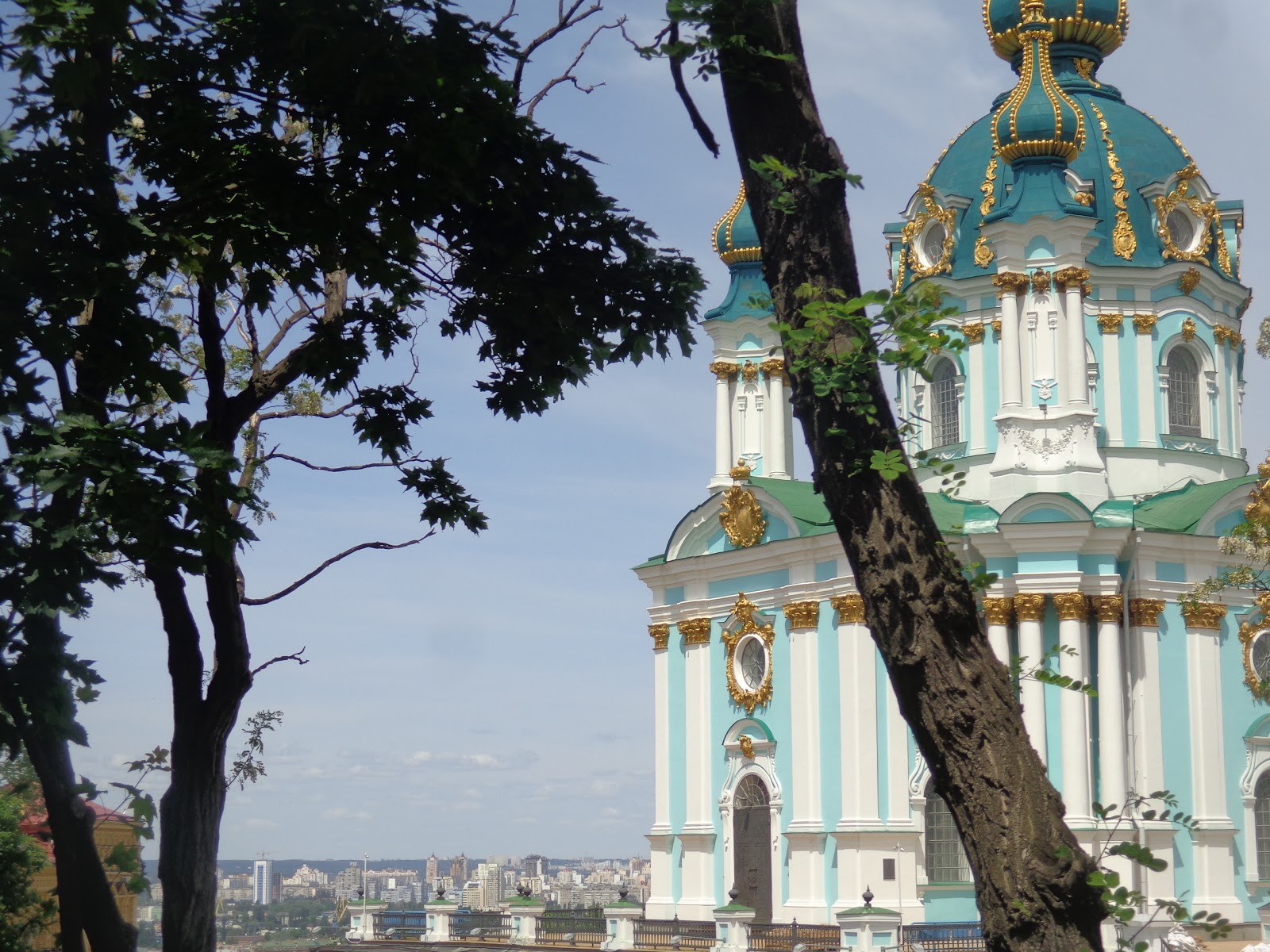
Even before independence, Ukrainian cities established events to mark their cultural distinction. The capital declared its first Kyiv Day in 1982; it is celebrated each year the last weekend of May, which happened to coincide with my visit. Most of the festivities were held in Sofia Square, home to St. Sophia Cathedral, a UNESCO World Heritage Site (top left). From the square, it is a short stroll to St. Andrew's Church (top right), which marks the apex of Andrew's Descent, a winding street that some people say shares a vibe with Paris' Montmartre (bottom left). We emulated the Bohemian lifestyle of writers such as Mikhail Bulgakov by stopping for a bit at a streetside cafe (bottom right).  
The road funnels pedestrians into Podil, a historic neighborhood that has become a hipster haven. The district's revitalization is apparent in its many building murals, including "Vidrodzhenia," or Renaissance (top left). Podil abuts the city's river port, where tourists can board ships for river cruises. TJ and I opted to stay on land and head over to Trukhaniv Island, a "summer resort" accessed by a pedestrian bridge (top right). From the center of the span, we could take in the extent of the Podil skyline from which we walked -- and where we likely would be visiting again many times in the future (bottom). 

Thursday, July 20, 2017

These attractions could bring many more visitors (113Cong.Rec.)

A work contact once told me that his city's claim to fame was that it was one of the few in the United Kingdom that were younger than the United States. I had to chuckle because, as I was walking around London, I often would be struck by the realization that almost everything around me was much older than my country. But of course, when you look around the city, you can still see many modern touches. 

The view from the Golden Jubilee Footbridge alongside the Hungerford Railway Bridge is definitely a metropolis skyline (top). Two recognizable landmarks are The Shard, a multi-use high-rise finished in 2012 (middle left), and The Gherkin, a slightly older but perhaps more distinctive building (middle right). The two structures stand like sentinels on either side of the Thames in line with London Bridge. If you look west instead of east from the footbridge, the major landmark is The Eye, which was the world's largest observation wheel when it was built in 1999 to celebrate the millennium (bottom). 
With its many cultural influences, London has evolved over time. Ethnic enclaves fill the urban area: Afro-Caribbean in Brixton, Scandinavian in Rotherhithe, and Middle Eastern on Edgware Road. Brick Lane, which is always bustling with locals and tourists alike, is a base for South Asians (top left). The road intersects with Fournier Street, which was named as such by the Huguenots who once lived there; the corner building started as a church, then was a synagogue and now is a mosque (top right). Chinatown is another cultural destination for tourists, mainly due to its proximity to Picadilly Circus, the Times Square of London.
 
Even traditionally English neighborhoods have been updated to attract modern Brits. Neal's Yard, a small area of the Seven Dials section of Covent Garden, was a derelict collection of warehouses until the 1980s, when an entrepreneur opened Neal's Yard Remedies and launched its gentrification (top). Carnaby Street, a main artery in Soho, used to be the center of the city's counter-culture: the home to plague victims in the 1600s, a hangout of Jimi Hendrix and The Kinks in the 1960s, and the lexus of punk in the 1970s. Now, it is a haven for hipsters with its trendy boutiques, restaurants, and public art (bottom left). Similarly, Covent Garden Market, once a local fruit and veg source, attracts the up-and-coming with a Jamie Oliver restaurant and a Charles Petillon art installation (bottom right). 
 
Even the more traditional markets have been modernized. Leadenhall Market, which started out as a simple stone structure, didn't gain its distinctive glass and wrought-iron design until the the late 19th century, and it didn't move its poultry market to make room for high-end shops until the late 20th century (left). Most likely, there were small shops along Hay's Wharf, where tea clippers unloaded their cargo in the 19th century; now, Hay's Galleria has been enclosed and covered to accommodate kiosks and cafes (right). 
Right outside the wharf is anchored not a clipper, but the Golden Hinde II, a replica of the galleon Sir Francis Drake landed on America in the 16th century (top left). (In case you're interested, the Cutty Sark, a famous tea clipper, sits in dry dock in Greenwich.) St. Katherine Docks is where Gloriana, the royal rowbarge, rests when it is not in use (top right). Perhaps the most modern maritime attraction is the HMS Belfast, a Royal Navy cruiser that was part of the initial German blockade during World War II (bottom). 
 
But by far, the most modern structure on the river is the Thames Barrier. The feat of engineering, completed in 1982, protects the city from tidal flooding (left). A pair of impressive engineering masterpieces lies under the river: The pedestrian tunnels at Woolwich and Greenwich were dug mostly by hand in the early 20th century to replace ferries as a means for South Londoners to get to the wharves and businesses on the north bank (right).