A few weeks after our weekend of walkabouts in and around London, TJ made a second stop in England, in which we got off our feet and onto some transport for a long holiday weekend. After work, we met at the train station to catch our ride to the southern coast. As we boarded the ferry from Southampton, we saw the Queen Elizabeth 2, or QE2, docked nearby (left). We merely crossed The Solent strait, not the ocean, but later that evening, after we arrived at our destination, the Isle of Wight, we spied the cruiser setting off for its trans-Atlantic journey (right).

 It was a bit of a hike from the ferry landing in Cowes to our accommodation, 24 Ward Avenue B&B, so Sage was quick to settle into his temporary digs (left). He managed to summon some energy to explore the backyard, especially after he discovered there was a pair of friendly resident dogs to share it with (right).

 With Sage ready for a nap, TJ and I struck out to explore the downtown. Just beyond the busy summer season and shy of Labor Day weekend, most establishments were sparsely patronized. We had the Cowes Ale House nearly to ourselves (left), and I didn't even finish my cocktail before a table at The Mess Canteen + Bar opened up for us to have dinner (right).

 The next morning, we tired Sage out again with a walk in the environs of Cowes. We started at the Northwood House and Park, a party pad during the Victorian era, which basically abutted the backyard of our B&B (left). Then we headed down to the harbor and traced along the esplanade, past the Egypt Point lighthouse, glimpsing the coastal cliffs in the distance (right). This was as close as we got to one of the island's main tourist attractions, The Needles.

 We decided the off-season bus schedules to the chalk rock formation were too limiting, so we headed across the island to Sandown instead. The beach town came off as run-down in the rain, so we quickly picked up some pasties and headed on to Ventnor. With some sun breaking through the clouds, the Victorian resort seemed a bit more inviting (top left). We got our bearings on a 3-D map of the island (top right), then set our heading for The Spyglass Inn (middle), where we sought refuge until the rain stopped enough to convince TJ to swim. The beach huts were locked up for the season (bottom left), so I took shelter under the awning of an out-of-business arcade while TJ took a dip (bottom right).


 We actually had planned to spend the weekend not at the beach, but in the New Forest, but by the time we got around to booking hotels, there was slim pickings within the national park, so we selected Salisbury instead. This city, on the fringes of the park, is full of Gothic walls (left) and thatched roofs (right).

 The market town sits at the confluence of five rivers, including the River Avon (top left), which formed the northern boundary of the grounds of our accommodation, the Grasmere House Hotel (top right). A little ways down the bank, the river once provided energy for a 16th-century paper mill, which has now been turned into the Old Mill Hotel (bottom).


 But, by far, the city's biggest claim to fame is Salisbury Cathedral, which has the tallest spire in the United Kingdom (top left). Toward closing time, we sneaked into a service, so we could spy the largest cloister and the largest close in Great Britain (top right). Unfortunately, we got to church too late to see its copy of the Magna Carta, but a view of the cathedral's architecture at night was quite liberating (bottom).


 TJ couldn't resist a foray into forest, so on our first night in Salisbury we hopped a bus to Ringwood, which sits right on the western border of the park. It is also home to Ringwood Brewery, where tours are by reservation only, so we sampled some of its suds at the Inn on the Furlong (left). After a few pre-dinner drinks, we headed to the very hopping Framptons for a lovely farm-to-table dinner (right).
 Many people use Salisbury as a jumping-off point to visit Stonehenge, but we opted to take a circular walk to Old Sarum. On the way up to the Iron Age hill fort, we stopped to read a commemoration stone in honor of William Pitt, Earl of Chatham (top left) and to look back on Salisbury, which up until 2009 was officially called New Sarum (top right). Eventually, we reached the fortifications, which were built by William the Conqueror to shield a castle (bottom left). Built around the same time, but outside the earthworks, was the city's first cathedral (bottom right), which supposedly lies on a ley line with the new cathedral and Stonehenge.


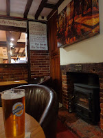
 After our six-mile walk, we treated ourselves to some well-deserved refreshments at The Pheasant Inn (left) before we ducked into Danny's Craft Bar & Kitchen across the street for a refueling repast (right).

 After cleaning up and depositing a tuckered-out pup, we headed out for a mini pub crawl. First, we hit up the Haunch of Venison, a former hostel for builders of the cathedral spire (top left). Its old bread oven contains what is purported to be the mummified limb of a cheater who literally lost his hand during a card game (top right). The gambler and a lady in a white shawl are said to haunt Salisbury's oldest pub; a few streets away, a woman dressed in black is said to be the resident spirit at The New Inn (bottom left). As far as I know, there's no paranormal activity at The Wyndham Arms, but to us it was worth a visit to have a pint with some alive and lively locals at the birthplace of Hop Back Brewery (bottom right).


