Not long after I arrived here, someone gave me a Walk magazine, thinking I would get some use out of it. Once I got over its title and looked inside, I decided the person had pegged me pretty well. It may seem a little funny to have a publication dedicated to something most people do on a daily basis. But in the United Kingdom walking is more than just a way to get from point A to point B; it is a beloved weekend activity.
I decided to jump on that bandwagon, albeit a little late, by committing to taking Sage into the countryside at least once a month for a relaxing ramble. I hesitated for a few months because I wasn't sure how Sage would take to lengthy public transport, but he was a total pro on the hour-long ride to Pangbourne (left). I disembarked at the train station for a short walk to Whitchurch-on-Thames, where we started our first official dog-and-owner hike (right).


The path gets its name from the Chiltern Hills, which we admired during water breaks throughout our walk (left). As the path started to get steeper, the weather got damper, but the surrounding North Wessex Downs provided us with a nice distraction from the drizzle (right).


At Hartslock Nature Reserve we took a quick but windy detour to an overlook, where once again I failed at taking a selfie (top left). We then descended to the Thames Path, which we followed partway back to the village (top right). A final tree-lined country road led us back to the main high street (bottom), along which is located The Greyhound. I was planning to lunch at the dog-friendly pub, but we made such good time that it wasn't open yet, so we jumped on the first train home and celebrated our first successful ramble with a mid-afternoon snooze.


A few weeks later, spring arrived for our walk along the Liss to Petersfield section of the Shipwrights Way (left). Our starting point, Liss, had hardly awakened for the day, and there wasn't much to see, so we quickly struck out for the country, where Sage had his pick of plants and shrubs to sniff (right).


For about the first half of the walk, we strolled through South Downs National Park and across the River Rother (left). We stumbled back on civilization, of a sort, when we reached Petersfield Golf Club (right). I took a wrong turn somewhere along the front nine, but I managed to get us back on track before getting struck by a golf ball.


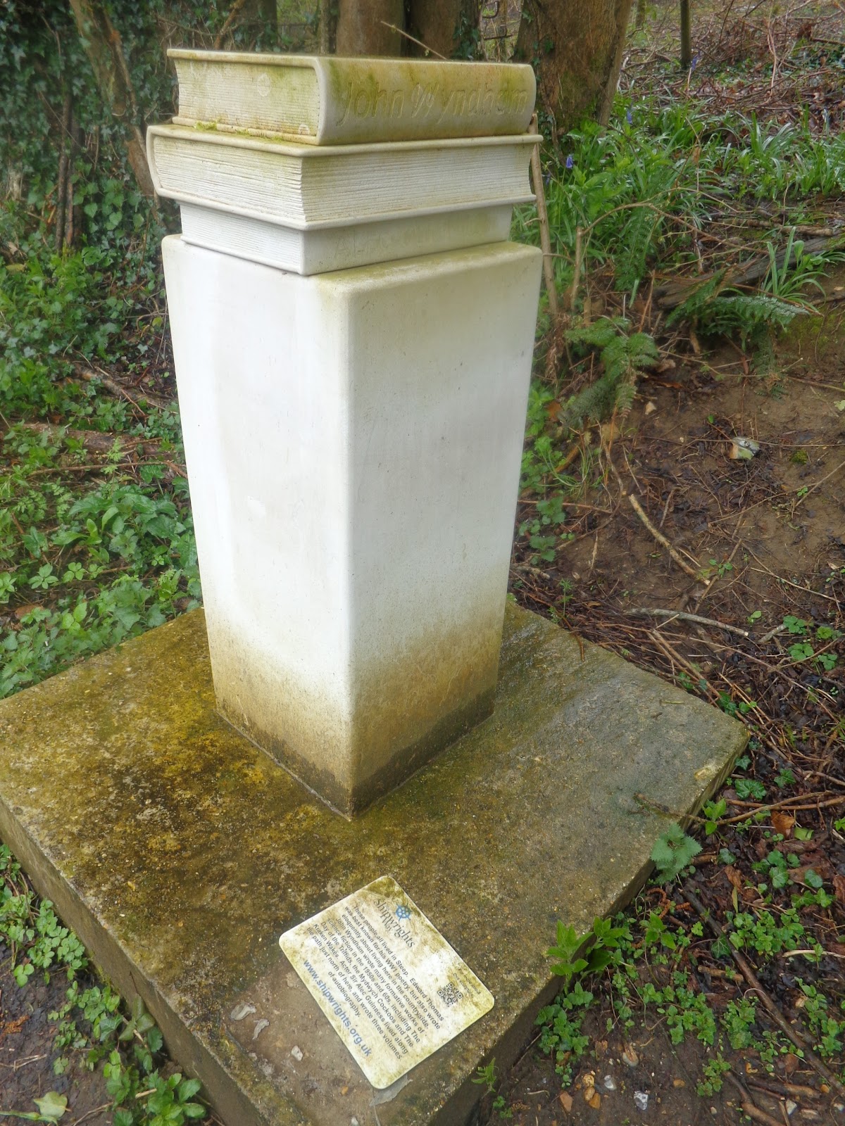
The second half of the hike took us past some lovely country homes, including a timber-frame house beside Tilmore Brook (top). Just down the road was the inviting Harrow Inn, which I hope to give a second look on a drier day (bottom left). The last point of interest before winding down the last meters to Petersfield was the "Stack of Books" sculpture (bottom right), dedicated to three native sons of the village Steep, including Alec Guinness, who lived right down the road in his formative years before he became a Jedi master.


Spring really showed its stuff during our third ramble: the Box Hill to Leatherhead walk. Despite its name, the hike began at Westhumble train station. There was a historic start to the day: Around the corner from the station was a gate with a plaque dedicated to diarist Fanny Burney; across the road was the 12th-century wooden Westhumble Chapel (left). It would be another 7 miles to our 21st century destination: Leatherhead, whose agricultural heritage was on display at its weekend market (right).


Besides its length, I knew this ramble would be more challenging because of its ascents and descents through the North Downs and Surrey Hills. The route started out flat enough, passing some dormant vineyards along the North Downs Way (left). Less than a half-hour in, I spied the Denbies Wine Estate in the distance, but I decided it was too early for a refreshment break. At many points, the path divided serene carpets of bluebells (right).


But then we got to our first obstacle: Sage balked at the Stepping Stones across the River Mole (left), so we had to make a short detour upstream to cross the river by footbridge instead. Later on, I balked at the 182 steps up White Hill, but Sage motivated me by eagerly bounding up the incline (right).


The climbs were more than worth it in the end, as they brought us to the summit of Box Hill, the first UK country park (left). Once in the park, for a while the route followed the Box Hill Hike, including past the Salomons Memorial viewpoint, named after the businessman donor of the parkland (right).


A little later, the trail connected to the park's Happy Valley Hike path, which guided us through Juniper Bottom (left). The latter name is more appropriate for the area as the route is lined with juniper trees, shrubs that have an evergreen feel (right). On this warm day, the shade of their needles was actually a welcome respite from the sun.


With yet another climb we reached Juniper Top, a huge field surrounded by the namesake shrubs (left). We took in a snack with the view before making the final down-up-down to King William IV pub, just outside Mickleham (right). Once again, the pub was not quite open, so we pushed forward to the final stretch.


From Mickleham the trail leveled out as it headed into Norbury Park then through the River Mole Local Nature Reserve (left). Right before we headed into Leatherhead, we passed Thorncroft Manor, a feudal manor from Norman times that has now been converted into an office building (right). With this walk, I think that Sage and I proved ourselves to be true ramblers. Now, I might even subscribe to Walk to get ideas for future adventures.

